Tuesday, March 31, 2009

Arlington Cemetery, Part III

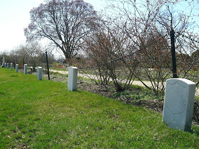
So, I mentioned in my previous post that I had many more pictures of Arlington, and I could not help but share some more here. In the interest of avoiding the confusion of my last post, however, I will list descriptions first, then add the pictures.

#1 A grave from the 1880's, when things were a bit more free-form at Arlington. The man's age suggests (31 at the outbreak of the war) that he served in the Civil War.

#2 The garden outside of Arlington House is ringed with Civil War graves, mostly men who died in the last two years of the war.

#3 The north side of General Crook's marker, with a Major's grave from the same era right in front of it.

#4 I very nearly stepped on G.V.H., pictured here. About a half-dozen similar markers were scattered on the hill leading up to Arlington House. Yet another example of the different styles of grave that were acceptable in the early days of the cemetery.

#5 These were three Revolutionary War veterans whose remains were moved to Arlington by the Daughters of the American Revolution.

#6 Here, among the largest swath of Civil War graves that I found in the cemetery, were the graves of George Washington Parke Custis and Mary L. Custis. G.W.P. Custis was the adopted son of George Washington who built Arlington House, and Mary was his wife.


Every Rose has its Thorn


At Right: Rose Greenhow and her daughter "Little Rose" at the Old Capitol Prison.

From her home on 16th Street near St. John’s Episcopal Church, Rose O’Neale Greenhow was perfectly situated as a spy for the Confederacy. Known as the Wild Rose, the widow was both socialite and seductress, playing host to a variety of politicians including President James Buchanan and William Seward.

After South Carolina’s succession in 1861 Greenhow was contacted by a U.S. Army captain who intended to switch sides and fight for his native Virginia. Realizing what great influence Rose Greenhow held in Washington society, the captain taught her simple code and established a means of communicating with her through a network of Southern sympathizers.

The Wild Rose found an informative paramour in abolitionist Henry D. Wilson*, a Senator from Massachusetts and Chairman of the Military Affairs Committee. A married man, Senator Wilson would sign his love letters to Greenhow as “H” (the letters would say such scandalous things as, “If fate is not against you, I will be with you this night…My love is all”). Through “H” Greenhow gleaned intelligence on Union troop movements.

As Union and Confederate troops prepared for war, Greenhow sent a message to Confederate General P.G.T. Beauregard, in which she passed along Union battle plans for the First Battle of Bull Run on July 21, 1861. The message was delivered just days before the battle on July 9th, via another female spy who tucked the message into the bun of her hair and warned Beauregard that “McDowell has certainly been ordered to advance on the sixteenth. ROG.” For her service, Confederate President Jefferson Davis credited Greenhow with the victory at Bull Run.

Greenhow continued to send coded messages, but unfortunately the downside of being well-known is being well-known. She was soon suspected of espionage and was arrested by the Secret Service in August 1831. Ever determined, Greenhow continued to send her messages from the Old Capitol Prison (at the site of the present day Supreme Court) and later in her home under house arrest, through candles in the windows.

In May 1862, the Federals released Greenhow and deported her to Richmond, Virginia, where she was hailed as a heroine. Jefferson Davis soon dispatched Greenhow to Britain to drum up support for the Southern Cause. Returning to North Carolina in 1864, Rose Greenhow met a tragic end. The ship she had been travelling on had run aground near Cape Fear during a storm. Despite the raging storm, Greenhow demanded to be taken ashore in a rowboat. The boat capsized, and Greenhow drowned. Upon her body, recovered having been washed ashore, was a cipher used for one of her many correspondences. Wow, she was persistent!

*Some historians debate whether or not “H” stood for Henry Wilson or his secretary Horace White.

Sources: Ann Blackman, Wild Rose.

Ishbel Ross,
Rebel Rose.

Wednesday, March 25, 2009

A Fence War


I have discovered in life that there are ways of getting almost anywhere you want to go, if you really want to go. ~Langston Hughes

As one of the first suburbs developed in Washington, a home in the gated community of Le Droit Park came complete with a colorful gingerbread exterior, picket fences, and flowerbeds. Bordering the traditionally black Howard University, this “white only” neighborhood was established in the 1870s when it was sold to Howard trustee and real estate developer Amzi L. Barber. No expense was spared by architect James McGill, and the lavish houses cost $4,000 to $10,000 (a large sum for the 1870s). Soon Le Droit Park was referred to as the “Flower Garden of Washington.”

Simultaneously developing in the 1870s was the University. Chartered through Congress in 1867, Howard University’s mission was to educate African-Americans at a time when the concepts of segregation and “separate but equal” were becoming entrenched n American society. Despite the constraints, Howard developed into a reputable university and a home for intellectual thought among African-American elites. Howard professors resided in the predominantly black Howard Town area just north of Le Droit Park. On weekends these prominent African-American citizens would stroll through nearby McMillan Park, by then designated as a black park.

With the increasing influence of the university community, Le Droit Park became the center of a “Fence War.” The mansions of Le Droit Park represented what African-Americans were struggling to achieve, in addition to what white society was trying to keep forbidden from them. Residents of Howard Town grew frustrated with the segregation and inconvenience of having to walk around the neighborhood to get to and from Howard University. In frustration, African-Americans in the community tore down the fences of Le Droit Park, including a board fence on 4th Street across from the University. Subsequently, by securing court injunctions the residents of Le Droit Park reconstructed the fences. The cycle repeated itself from 1886 to 1891, when a compromise permanently removed the fences.

Not long after, the African-Americans moved in to the neighborhood; early residents included poet laureate Paul Laurence Dunbar and the first black municipal judge, Robert Terrell. As has often been the problem with racial tension, where blacks went, whites left. By the early 1900s Le Droit Park became a community for affluent African-Americans, gaining prominence in as a home for African-American congressmen, doctors, lawyers, and a frequent of Langston Hughes in the 1920s.

Sources: “How Le Droit Park Came to be Added to the City,” The Washington Times, May 31, 1903 (page 5).

Jacqueline M. Moore, Leading the Race (Virginia: The University of Virginia Press, 1999).

“Le Droit Park Historic District,” The Le Droit Park Historic Society, DC Historic Preservation Office.

“Neighborhood History,” Le Droit Park Civic Association, available online at http://www.ledroitparkdc.org/ (25 March 2009).
Picture Source: “How Le Droit Park Came to be Added to the City,” The Washington Times, May 31, 1903 (page 5).

Sunday, March 22, 2009

Arlington Cemetery, Part II

In my first post on the topic, I focused mainly on Arlington House and the history of the site before it became a cemetery. I revisited Arlington National Cemetery this (Sunday) morning, with the goal of finding Civil War era graves. The Union dead were the first soldiers to be buried at Arlington, after the property was seized at the outset of the war. So, seeking these veterans out seems like a way to keep these posts roughly chronological. In addition, I am a total nerd for the Civil War. I have read a lot about it, know a lot about it, and I had spotted several familiar names on markers around the cemetery on my first two visits. So I really wanted to check it out.

I decided that rather than actually speak with someone who knows the area (like, say, a tour guide), I would just walk around and see what I would find. I ended up taking many pictures, as it was a gorgeous day. What follows, then, is basically my visit in pictures.

The first Civil War era grave I stumbled upon. The Civil War veterans are easy to spot because the names are framed by this badge shape, and because in the spirit of the time, they all have the state they fought for listed.


Nearby that first grave, I found the towering marker for Joseph Wheeler. Wheeler was actually a Confederate general during the Civil War, and ably commanded the cavalry of the Army of Tennessee. Later, however, he (re)joined the United States military and served as a general during the Spanish-American War, earning himself an incredibly tall spot in Arlington.


General George Crook was also buried beneath an elaborate gravestone. The back of which, pictured here, depicts him accepting the surrender of Geronimo and his men.


Throughout the cemetery, one can find graves from the time period mixed in with everyone else, as with the three visible here.


Eventually, however, I found a vast area that was almost entirely Civil War veterans, in the northern end of the cemetery.


I even found a monument honoring the Confederate dead. The graves circling this monument were all Southern veterans, and their graves were distinguished with a slight point at the top, rather than the smooth semi-circle topping most markers at Arlington.


Sunday was the third day of spring, and I wanted to photograph this robin, but he was having none of it.


It was also a lovely day. Our nation's heroes have a truly peaceful place to rest.

Saturday, March 21, 2009

Duel of the Month Club: Decatur v. Barron

Steven Decatur (Left) v. James Barron (Right)


We here at Ten Miles Square love a good duel. We are of the belief that when it comes to honor, all challenges must be answered! Though we are likely to run away when personally affronted, if others want to "have it out," that's okay with us-- we'll watch from afar...or read about it a few centuries later.


Fortunately for us, DC was a prime dueling locale. To kick us off, a battle between Commodore James Barron and Commodore Stephen "Conqueror of the Barbary Pirates" Decatur.

It all started during the Napoleanic Wars, when the British were bullying the nascent American navy, and impressing American sailors into the British navy. In 1807, Barron's ship, the Chesapeake, was approached by the somewhat larger British Leopard. Judging his odds unfavorable in a true contest, he elected to fire his guns once, and promptly lower his colors in surrender. Though Stephen Decatur was a former subordinate and close friend of Barron to whom he admitted that he owed his career, Decatur sat on the the jury that would issue a court-marshall and five year leave to Commodore Barron for the "Chesapeake Affair." An outraged Barron left the United States and returned in 1818, well after the War of 1812 concluded. Decatur remarked on Barron's inaction in the war, stating that he had failed to serve his country and do his patriotic duty. After a period of correspondence, the two set a date on March 22, 1820 to restore their honor in a duel.

Admittedly, this duel did not take place in the District. It occurred just over the DC line in Bladensberg, Maryland. But, Stephen Decatur lived in Washington, and at any rate it was illegal to duel in the District (but not in MD). After a last minute attempt to reconcile, the two gentlemen counted off their eight paces, turned and fired. Both were wounded; for Decatur the wound was mortal. He was rushed back to his home in Lafayette Park where he slowly bled to death in the evening of the 22nd. So grieved was the nation at the War Hero's death that the U.S. Senate ajourned so that members could attend his funeral procession, and towns across the United States were named in his honor.

Friday, March 20, 2009

And In-flew-Enza


The photo of the flu ward at Walter Reed Army Hospital inspired me to learn about the Great Influenza of 1918. Too often, the Capital is isolated from the rest of the country; it’s a place that hears the problems of the nation but doesn’t necessarily see them. The influenza pandemic in 1918 is a great example of how the city shared in a national tragedy. As the worst pandemic in history, the Great Influenza or Spanish Flu infected 20-40% of the World’s population, causing 50 million causalities. With sudden symptoms of aches and fever, pneumonia, and hemorrhaging of the lungs and intestines, the flu managed to kill 675,000 Americans in a mere 6 months.

Though the virus appeared in the United States in March 1918, the first casualty in the District was on September 21st; the victim had been a railroad brakeman who had been exposed to it in New York. From his DC headquarters, Surgeon General Rupert Blue was just beginning to recognize that the flu outbreak was about to wreak havoc. Just one day later 65 cases were reported at Camp Humphrey (now Fort Belvoir, near Arlington Cemetery). That day the government issued its first warning to the public, stating among other things to:
“-Avoid needless crowding
-Smother your coughes and sneezes
-Food will win the War—Help by choosing and chewing your food well
-Avoid tight clothes, tight shoes, tight gloves.”

By September 26th Senator John Weeks of Massachusetts called for a resolution appropriating a hefty one million dollars toward combating the outbreak. The resolution sped through the Senate and House in two hours, passing without a single dissent. The United States Public Health Service (now the NIH) set up an emergency hospital in the District that could accommodate 500 patients, and the Surgeon General of the Navy made available 40 medical officers. At Walter Reed the mortality rate of flu victims with pneumonia reached 52%. For 1918, the mortality rate in DC reached 23.6 deaths out of 1000 dying compared to 16.8 in 1917. To give a comparison, the average mortality rate in 1918 for the 46 largest US cities was 19.6.

In a short time coffins became a scarcity. At one point, DC Health Commissioner Louis Brownlow seized two railcars full of coffins bound for Pittsburgh, another hard-hit city. Local funeral home owner Bill Sardo later recalled that “from the moment I got up in the morning to when I went to bed at night, I felt a constant sense of fear. We wore gauze masks. We were afraid to kiss each other, to eat with each other, to have contact of any kind. We had no family life, no church life, no community life. Fear tore people apart.”

Though the USPHS, the Navy and Army worked diligently to create vaccines that had moderate success, people were generally at the mercy of virus and could only wait it out. Over the next few months the emergency hospital in DC reduced its size to one hundred beds and by March 1919 it had dispensed operations all together. The flu had disappeared as suddenly as it had arrived, having left its mark of fear across the nation.

Sources: John M. Barry, The Great Influenza (New York: Viking Penguin, 2004).

Alfred W. Crosby, America’s Forgotten Pandemic, Second Edition (NewYork: Cambridge University Press, 2003).

“Death Rate Increase in 1918,” New York Times, January 6, 1918.

United States Department of Health and Human Services,
The Great Pandemic (available online: 3/20/09).

Picture Source:
"Walter Reed Hospital flu ward", Harris & Ewing glass negative, c. 1919 (available online: 3/20/09). *Shorpy is a fantastic hi-def vintage photography website, with many collections from DC.

Sunday, March 15, 2009

Arlington Cemetery, Part I


Arlington National Cemetery is probably one of the most popular historical destinations around the District, outside of the National Mall area. I had visited the cemetery a few months after moving to the city, but focused on finding the grave of a recently buried grandfather to one of my friends. I didn't stay very long to look around. I returned this past week determined to see a few of the tourist sites I had overlooked the first time. Winding my way up the hill toward the Lee House, I found myself pointing out graves to my companion with increasing excitement. "Wow, there's George Crook!" "Hey, that's Justice Burger." And so forth. I realized that there is far too much there for me to really take in at once. Therefore, I have decided to take advantage of what time I have left before the cherry blossom tourists arrive, and revisit Arlington a few times in the next two weeks and see what neat little tidbits I can dig up.

Almost everyone in the District seems to know a few basic things about the cemetery, but with so much history, I think a bit of an overview might be in order, as a preface to the more focused posts that will follow. To that end, here is a breakdown of a few anecdotes and details I gathered during my most recent trip:

Things you probably knew already:
-The property on which the cemetery was sited had been owned by Robert E. Lee.
-Lee's house, known as Lee House, Arlington House, or fifty other names, is still standing at the highest point in the cemetery.
-The house was originally built by a (indirect) descendant of George Washington, George Washington Parke Custis.
-The property was seized by the United States government during the Civil War after Lee resigned his commission in the US military and moved his family south, away from the armies of the North.

Things you might have known already:
-The first military personnel to be buried at Arlington were Northern soldiers who died fighting in the Civil War - an irony which was not lost on those who had designated the former Lee property as a burial site.
-One of Robert E. Lee's sons actually won the house back more than a decade after the war by suing the federal government. However, as the house was completely surrounded by graves, he ended up selling it right back to the United States government for $150,000.

Things I definitely did not already know:

-The very first person known to be buried at Arlington cemetery wasn't a veteran! It was Mary Randolph, a cousin of several residents of the house, who apparently died after caring for her son, who had been gravely wounded in an accident. Her tombstone (pictured below) lies on the hillside, beside one of the paths leading to Arlington House.
-One of the Lees' slaves, Selina Gray, who had been left in charge of the plantation when the Lees fled, actually saved some of George Washington's personal effects from looting by Union soldiers. When Gray noticed that the occupying Union forces had begun stealing items from within Arlington House, she alerted no less than General Irvin McDowell, who had what remained of Washington's effects sent to Washington for preservation.

Below: The grave of Mary Randolph.

Friday, March 13, 2009

A Friday Blog Round-up

Thought we should check the internet to see what's already been covered.

The Edwardian Promenade has several entries featuring DC History. A few highlights include:
-Booker T. Washington dines with Teddy Roosevelt
-Presidential Inauguration
-The "Colored" Aristocracy in DC

Blogs about Honest Abe
-A. Lincoln Blog
-Lincoln Studies

A Blog about Presidents at Large
- American Presidents

And lastly, a little bit of trivia for you. Yesterday marked the 76th anniversary of FDR's first Fireside Chat. One day later (today) the banks re-opened after FDR had mandated a "bank holiday."

Wednesday, March 11, 2009

The Rise of Punk

What Motown is to Detroit, what Country is to Nashville, what the Blues are to Chicago, what Jazz is to New Orleans, and what Hip Hop is Atlanta; Punk Rock is to Washington, DC. It’s difficult to imagine this city of suits and pearl necklaces as having any kind of punk scene, let alone imagine it being located in the preppy neighborhood of Georgetown. Yet, it was there in Georgetown, and later on around Dupont Circle and Adams Morgan, that Punk Rock gained traction and became a musical genre in the 1970s and 80s.

Founded by a professor in the astronomy department in the 60s, Georgetown’s radio station WGTB primarily played light rock. However, by the 70s the oldest Jesuit university in the country’s radio station had become a haven for radical thought, featuring programs on Maoism and feminism. The station drew heavy criticism from political leaders, including the likes of Spiro Agnew, who believed that the station aired Third World propaganda. WGTB continued on in their radical ways, eventually attracting local garage bands to play in DC. The District’s first punk band was Overkill, based out of Catholic University. Other successful bands later emerged out DC, notably: The Slickee Boys, Government Issue, Bad Brains, and Fugazi. (At Right: Concert Flyer for the Slickee Boys)

Every good rock band needs a good scene, and DC had plenty that sprung up out of garages and old buildings. Among them was the Atlantis Club—sort of the CBGB of Washington. Rock bands yearned for an opportunity to play at the same locale as Tom Petty and The Heartbreakers and the Ramones. Bad Brains so wanted an opportunity at the Atlantis Club that they even wrote a song called “Jammin’ at the Atlantis Club.” Unfortunately, the Atlantis Club shut down in 1979 before Bad Brains got a chance to headline there. The owner of the club claimed that at every show the fans would destroy the building, ripping the wiring, tearing down directories. He did not mention that the building frequently violated fire codes and liquor laws. When the club reopened a year later under new ownership, it would be called Club 9:30 for it’s location at 930 F Street, NW.

With the hottest club in town shut down, punks turned elsewhere for a music venue. Enter Madams Organ up in Adams Morgan. A yippie commune founded by students from the Corcoran Gallery of Art, Madams Organ joined the music scene by hosting a pro-legalization of marijuana benefit concert every July Fourth on the National Mall. As yippies became increasingly interested in punk, they began holding more and more shows at their row house on 18th Street, mainly in order to raise money for the monthly electric bill. The house was smelly, battered, with light fixtures inside of tin cans. Naturally, it was instantly popular.

While punk gripped the city, DC was also gentrifying. In 1978, WGTB was shut down by university president Father Healy (although how a station advocating abortion counseling at a Jesuit institution had so much staying power is a mystery). Rent increased for the Madams Organ building, and no fundraiser or benefit show managed to save it. The last concerts were held in April 1980. Despite the hardship, punk remained strong in DC throughout the 80s, if only a little less prevalent.

Both the 930 Club and Madams Organ are still in existence today. 930 Club can be found at 9th and V Streets, NW. It is still one of the most popular venues in the city. A newer Madams Organ is in Adam Morgan on the 2400 block of 18th Street. Trust me, you’ll know it when you see it.

To learn more about Punk Rock in DC, there’s an interesting (and free!) city tour guide at the Capitol of Punk website (http://yellowarrow.net/capitolofpunk/). There’s even a video podcast!

Sources: Mark Andersen and Mark Jenkins, Dance of Days (New York: Soft Skull Press, 2001).

Neil Augenstein, “Places That Are Gone,” (WTOP Radio Online: 2007)
http://www.wtopnews.com/?sid=1018175&nid=226&pid=0.

Picture Source: Slickee Boy’s Concert Flyer, www.30underdc.com.

Sunday, March 8, 2009

Bizarre Bites, Part I

A few strange tidbits from the annals of Washington, DC history:

On June 5, 1663, a man named Francis Pope laid out a plantation on the land that is now the heart of the capital, stretching 17 blocks west from where the Capitol building stands today. The western boundary of this property was a creek (now gone) called the Tiber. As though having a man named Pope living on the Tiber was not enough, he also named his estate "Room." Thus, it can be said that where Washington now stands, there was once a Pope in Room on the Tiber. Ironically acting the prophet, it seems Pope was also the first to predict that a great city would one day stand on that very ground.

If you thought moving the nation's capital to southern Maryland was the last word in Congressional relocation, you are sadly mistaken. After the Confederacy's attempt to establish a wholly new capital 100 miles to the south in Richmond, a new relocation effort was led by a veteran of the Civil War, General John Logan. Logan and the good people of Missouri believed that moving the capital to St. Louis would acknowledge and include the people of the burgeoning West. The people of St. Louis adopted several resolutions but, alas, could not convince enough people in the East to disassemble the capital, ship the pieces to St. Louis, and reassemble them there.

Washington, DC was named not by Congress, or Charles L'Enfant, the city planner, or popular opinion, but by the unilateral decision of three men. These men, the first commissioners of the city, charged by congress to oversee the construction of the new capital, wrote a letter to L'Enfant on September 9, 1791 declaring that "We have agreed that the Federal District shall be called the 'Territory of Columbia,' and the Federal City the 'City of Washington.'" Apparently, everyone else simply followed suit and the city became "Washington."

Source: George Rothwell Brown, Washington: A Not Too Serious History (Baltimore: Norman Publishing Company, 1930), 3-4, 42-43, 106.

Friday, March 6, 2009

DC in the BC...and Later

Below: John Smith's Map of Virginia, 1612.
It was the end of the Ice Age, and things were looking up. The glaciers were receding, causing the rising sea levels that would form the Chesapeake Bay. The climate was warming. By ten thousand BC, the first Washingtonians settled into the area. Over the next few thousand years field and forest developed.

The surrounding land of present-day Washington was rich with game and stone to make tools. Around 800 CE, experiment with agriculture began with the growing of maize. Squash, beans, and potatoes were later added to the diet. By 1500, the people around the Potomac River had become so numerous that both hunting and farming were necessary in sustaining the population of the region. The people who had settled into the area were of the Piscataway Conoy Nation, a collection of tribes unified during the 16th century in order to ward off Iroquois invaders. These Eastern Algonquian-speaking Native Americans developed a system of chiefdom whereby the leader of a village, a werowance, was subject to a single supreme chief, known as the tayac.

One of the larger villages in the region was located in present day Anacostia. Identified by Captain John Smith in his 1612 Map of Virginia, the village and people were referred to as the Nacotchtank. Smith estimated the village population to be at around 200, with 60 warriors. The village encompassed the area from Bolling Air Force Base, following the Anacostia River to Anacostia Park. The word Nacotchtank has been translated to mean "a trading town," and this town along with the Patawomeke village were the two larger villages in the region. These towns served as "gateway communities," allowing the tayac to control long-distance trade, such as beaver pelts from the north. The Nacotchtanks were variably referred to as Nacostins or Analostans, deriving the name Anacostia.

Not much is known of daily life among the Nacotchtank. What we do know is that in 1622, the English colonists burned and plundered the Nactochtank village, in order to obtain corn. The following year, Captain Henry Spelman led a group of Englishmen on trading mission along the Potomac. Spelman was an interpreter for the British and presumed himself to be in good standing with the local Native Americans. However, whilst traveling Spelman and 19 of his men were killed by the Nacostins, with one survivor, Henry Fleet, becoming captive at the Nacotchtank village.

What happened to the Nacotchtank? Escaping 5 years later, Fleet later became a skilled trader and interpreter as Spelman had been before him. Fleet's writings mention that by the 1640s the Nacotchtanks were located at a small village in the Georgetown area. A fragment population had inhabited Analostan Island, later named Mason's Island and even later referred to as Theodore Roosevelt Island. Within 40 years of contact with the Europeans, the population of the Piscataway Conoys had dwindled to one quarter of what it was when Smith first greeted them in 1608. Violence and disease had taken its toll on the Nacotchtanks who faded into obscurity by the 1680s; their lands soon covered by farm, plantation and town.

Of Interest: Captain John Smith National Historic Water Trail, http://www.nps.gov/cajo/

Sources: National Park Service, "Civil War Defenses of Washington: The Native People, " Available online: http://www.nps.gov/cwdw/historyculture/the-native-peoples.htm (March 2009).

Piscataway Conoy Tribe of Maryland, "History," Avaiable online: http://piscatawayconoy.com/content/learn/history.html (March 2009).

Stephen R. Potter, Commoners, Tribute, and Chiefs (Charlottesville, VA: University of Virginia Press, 1993).

John Smith, The Generall Historie of Virginia (London: Printed by I.D. and I.H. for Michael Sparkes, 1624).
Photo Source: John Smith, "Map of Virginia," Library of Congress, 1612.

Wednesday, March 4, 2009

Tourist destination number 1


Above: The National Mall circa 1900, taken from the Smithsonian Castle facing the Washington Monument


Visitors to Washington DC today flock to the National Mall, undoubtedly one of the city’s most iconic sights. Interestingly enough it is also one of the city’s most fluid spaces, constantly changing as new administrations and generations of designers seek to make their mark on this grand public landscape.

Certainly, the Mall has been around since the beginning, conceived of in Pierre L’Enfant’s 1790 city plan as “a grand avenue 400 feet in breadth, and bordered with gardens,” that would serve to visually connect the new Capitol building with a still un-designed monument. Plans for the Washington Monument were later drawn up by prominent early American architect Robert Mills, and the towering obelisk was set to sit on axis with the White House, creating the ultimate axial triumvirate of White House, Monument and Capitol Building

However, L’Enfant’s plan was carried out slowly as the city emerged from the swamp, and it wasn’t until 1848 that construction was begun on the Monument using a modified version of Mill’s original design. As the structure began to rise, it became apparent that somewhat accidentally, the site chosen was about 370 feet east and 125 feet south of the location that L’Enfant had intended, tragically breaking the sacred axial relationships. Luckily, the times ‘they were a-changing’, and in his 1851 plan for the Mall, landscape architect Andrew Jackson Downing saw this mistake as his opportunity to turn the space into a sprawling romantic landscape more in tune with the Victorian sensibilities now in vogue. By the end of the 19th century the Mall had become an amazing bucolic landscape scattered with odd trees, the occasional sheep, and eventually bisected by a railroad.

This ‘loose and free’ version of the Mall was fairly short lived. After the earth shattering Columbian Exposition in Chicago in 1893, architecture across the US took a right turn and began emulating the simplified Neo Classical buildings that had populated the fair’s stunning ‘White City’. City beautiful movements were established in major metropolitan areas all over the country, and a senator from Michigan, Robert McMillan, took it upon himself to see that Washington DC didn’t fall behind the trend. He formed a committee, later to be named the McMillan Commission, and with a roster of such architectural greats as Charles McKim, Frederick Law Olmstead Jr., and Daniel Burnham - principal architect of the Chicago Fair, they composed a new plan for Washington in 1901.

The McMillan plan was a harkening back to L’Enfant’s original designs for the city, and included the restoration of the National Mall. The railroad was removed, the central axis was re-turfed, and all trees were moved to the edges to once again give the effect of a “broad avenue.” This restructuring also re-emphasized the original axis of the Washington Monument and Capitol Building, later strengthened by the addition of the to 1922 Lincoln Memorial, and then completed, some would argue, with the 1960 construction of RFK Stadium to the east. New buildings along the Mall, like the 1910 Museum of Natural History and the 1941 National Gallery of Art, were designed using a streamlined classical ideology inspired by the Columbian Exposition. Today the red brick Smithsonian Castle, constructed by James Renwick Jr. in 1847, remains a lone survivor of the romanticized Victorian Mall.

Despite it’s major and lasting effect on the Mall’s landscape, the McMillan plan was actually only ever 50 percent completed. Perhaps because of this, every so often the idea of a more complete or finished National Mall is revisited. During World War I, several temporary structures were put up alongside the Reflecting Pool to house the influx of wartime workers, and were actually not fully removed until 1971. Following this, in 1973 a new plan to clean up the Mall and rework the pedestrian walkways and transportation systems was instituted in time for the National Bicentennial celebrations in 1976. Now a hallmark of the Mall’s landscape, new monuments also occasionally make their way into the mix, with the most recent being the World War II memorial, completed in 2004. The subject of much debate during its construction, its showy and copious water features are now beloved by tourists and residents seeking refuge from DC’s insidious swamp summers.

Currently, there is another Mall master plan on the boards, led by the National Park Service - the Mall’s official steward, and the non-profit National Trust for the Mall. Plans available here seem to show a tidying of the landscape’s more recent bucolic additions - the hot dog stands - and an increase in public friendly facilities like restrooms and water fountains. For those who are interested, they are holding hearings for the public in the upcoming weeks, offering you the opportunity to be a part of the history of this ever-changing national landmark.

Sources: “The Washington Mall Circulation Systems”. Prepared for the National Park Service, Department of the Interior, United States of America by Skidmore, Owings & Merrill. October 1973.

The National Park Service, “The L’Enfant and McMillan Plans”, http://www.nps.gov/history/Nr/travel/wash/lenfant.htm.

Photo Source: Library of Congress Prints and Photographs Division: http://memory.loc.gov/service/pnp/det/4a10000/4a19000/4a19200/4a19291r.jpg

Tuesday, March 3, 2009

An Unbiased Assessment


Above: L'Enfant's planned capital.

A few weeks ago I was speaking with a friend of mine who is enrolled in the history graduate program at Yale. He and I were discussing the merits of writing biased history - that is, writing a historical essay or book that makes plain the author's feelings about the event or person being described. This could mean anything from applying anachronistic moral standards to an historical event (e.g. 'the curse of slavery was thus brought to the shores of Virginia...'), or just making it plain how you feel about historical actors (e.g. 'In a characteristically bold stroke, Lee brilliantly...'). I was of the opinion that I would rather the author be up front about his or her opinions, rather than attempt to write an "unbiased" work that would ultimately convey the author's views in an indirect manner while feigning objectivity.

As a result, while perusing books about the history of the Washington area, I settled on two tomes from the 1930's: Washington: A Not too Serious History by George Rothwell Brown, and Virginia: The Old Dominion by Matthew Page Andrews. Both of these books reflect the time period in which they were written via their open editorializing of their subject material. Brown, for example, writing concerning the election riots I discussed in an earlier post, said that "[the riots] have cured many of any desire for a repetition of such scenes, and have convinced others that perhaps the preservation of a calm and serene atmosphere for the deliberations of Congress and the labors of the President is worth more than the right to vote." We know where Brown stands on the issue, so we can take his presentation of the subject with a grain of salt, knowing that he is likely to frame the problem in such a way as to make his reader take his side.

Andrews' Virginia is similarly up front about the opinions of the author. For example, as I was reading about the design of the Federal City, Andrews seemed to be taking pains to emphasize the contributions to the city's planning of men other than Charles L'Enfant, especially Thomas Jefferson. Jefferson, it seems, gave the city planners the layouts of several European cities, as well as Annapolis, Maryland, to use as models. Andrews claims that this was an important contribution, and that in many respects, the plan for the District resembled that of Annapolis. Not being an expert in architecture or city planning, I might be inclined to take the author at his word and believe that Jefferson powerfully influenced the design of the capital.

However, as I mentioned, Andrews seems to have really liked Jefferson. After looking further into the matter, it seems that Andrews was inclined to believe most anything Jefferson did to be good, right, and true. Indeed, discussing Jefferson's decision to leave President Washington's cabinet, Andrews declares Washington to have been an autocrat. A quick glance at Encyclopedia Brittanica further confirmed that Annapolis was not a particularly important influence in the design of the District, and that L'Enfant drew much more inspiration from Paris and other European cities. Had Andrews been more circumspect in his allegiance to Jefferson, I may well have never given the matter a second thought. As it stands, it seems President Washington's suggestion that the White House be a mile from Congress was ultimately just as influential.

Sources: George Rothwell Brown, Washington: A Not Too Serious History (Baltimore: Norman Publishing Company, 1930), 215.
Matthew Page Andrews, Virginia: The Old Dominion (Richmond: Dietz Press, 1949).

Photo Source: University of Wisconsin Digital Collection: http://digicoll.library.wisc.edu/History/data/images/NolenMadsn/reference/WashDCr.jpg

Monday, March 2, 2009

The Great Knickerbocker Storm of 1922

The title of this storm alone merits mentioning it. Washington, DC’s single largest snowfall began in South Carolina on January 27, 1922, pushing slowly north. By the morning of the 28th, accumulation in the Capitol City reached 18 inches. The snow did not stop until the morning of the 29th, with the official record of snowfall reaching 26 inches, though Rock Creek Park recorded 33 inches that day.

The sheer weight of the snow collapsed the roof upon moviegoers at Crandall’s Knickerbocker Theatre; the largest theatre in DC at the time. The collapse killed 98 and injured 133; making it one DC’s all time worst disasters. To make it more tragic, the owner owner of the theatre, Harry S. Crandall, committed suicide in 1937, leaving a note reading, "I'm despondent and I miss my theatre so much." For more information on the storm visit the Washington Post's article (A Winter's Tale of Tragedy) or the DCist's blog posting (Knickerbocker Storm).

As for me, I’m trying to come up with a name for last night’s 6 inch snowfall that will go down in history like the “Knickerbocker Storm.” The best I’ve got so far is the “Day of the Ugg Boots 2009.”
Picture Source: Washingtonian Division, DC Public Library.

Sunday, March 1, 2009

Working for the Weekend

It’s the weekend. My favorite time of the week; a time for sleeping late, brunch, concerts, movies, restaurants, and of course the Smithsonian. Ah yes, how would the both the Washingtonian and tourist live without the Smithsonian? Not completed until 1846, how did they ever live without it?

For starters, visiting government buildings was quite popular among visitors. One could check out the new inventions at the Patent Office located where the Old Post Office building stands. Over at the Bureau of Indian Affairs, one could study the portraits of Native American chiefs painted by Charles Bird King. But all that gets dull after awhile, and through my researching I’m left with two conclusions on public pastimes prior to the Smithsonian: there was the theatre and there was horse racing.

At the turn of the 19th century DC was a fairly rural community, just beginning to sprout up. The town’s population totaled at just a little over 8,000—that’s not promising for those who love the nightlife. Despite the small population, by 1805 the District managed to have one theatre, the Washington Theatre. The theatre was located on the northeast corner of 11th and C Streets and was described by Londoner Francis Trollope as small, dirty, and lacking décor. She was appalled by the coarse manners of American men, who would stretch out over the box seats, constantly chewing and spitting tobacco. Indeed, the night Ms. Trollope visited she witnessed one man in a fit of vomiting, commenting that no one around him seemed bothered in the slightest. Sadly, the theatre burnt down in 1820. It was rebuilt in the same location and managed by Italian musician Gaetano Carusi. The Washington Theatre, known as Carusi’s Saloon or the City Assembly Rooms, later played host to President John Quincy Adams’s inaugural ball.

On to horse racing. It is believed that the earliest racetrack was an oval located between 17th and 20th Streets, across from Pennsylvania Avenue and in to Lafayette Park. It was operating as early as 1797. A short time later, another track opened in what is now the South Petworth area, just west of the Soldiers Home. Both of these tracks are believed to have been run John Tayloe, DC’s wealthiest resident (of the Octagon House no less) and avid horse breeder. So popular was racing, that the Washington Jockey Club was founded in 1821 to regulate the races. The Club established gate tolls, types of heats to be run, entry fees, and appointment of the judges. Incidentally, the Jockey Club outlawed gambling in any form. Their attempt at morality failed, as they were wholly unable to stop wagering. Bet you didn’t know there was a racetrack that close to the White House!

Sources: Robert Harrigan, Pastimes in Washington(Bowie, MD: Heritage Books, 2002).

Campbell Gibson, “Population of the 100 Largest Cities” (US Census Bureau: 1998).